C r i t i c a l C a r t o g r a p h i e s
⬇
Pajaro Valley Flood Archives
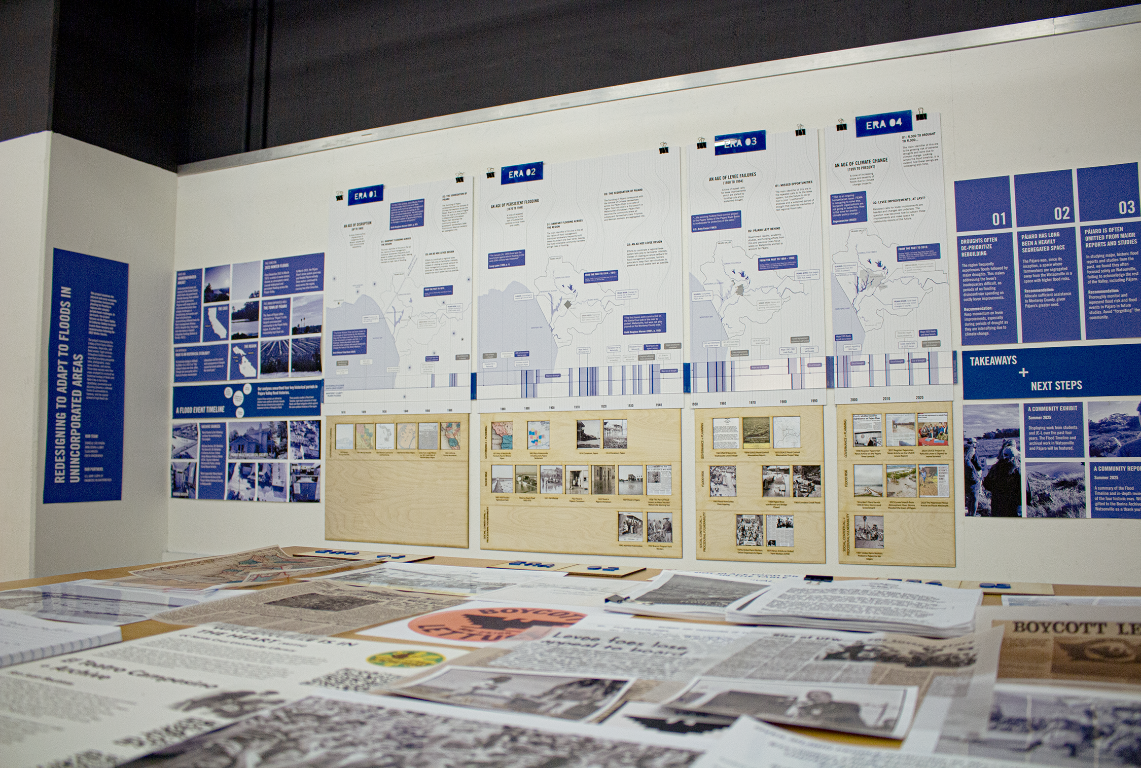
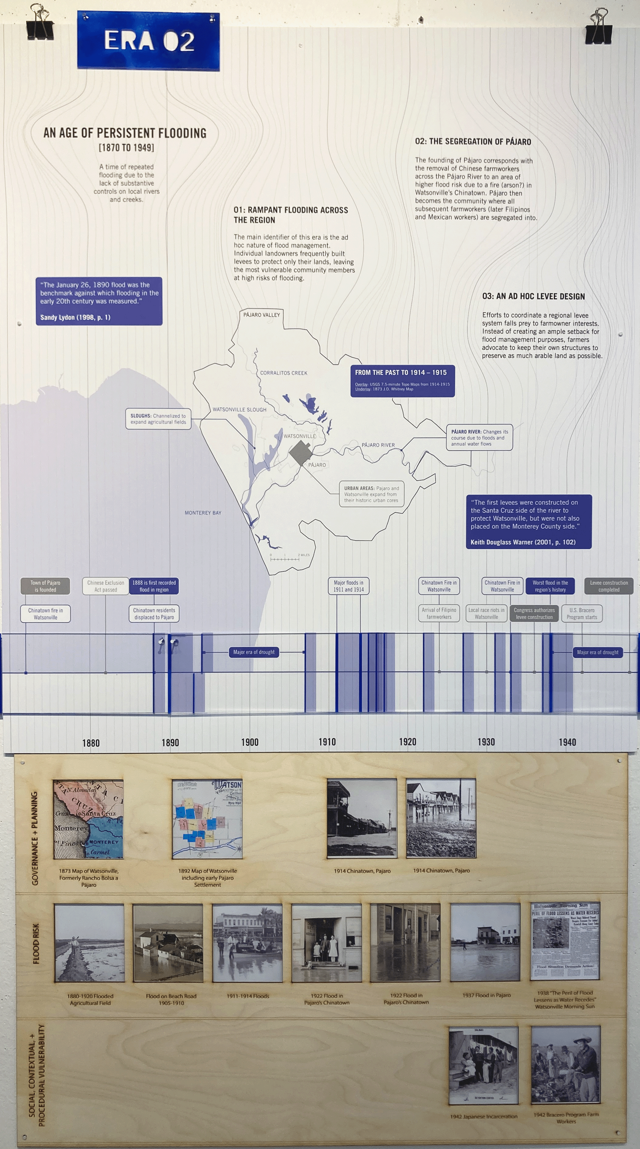
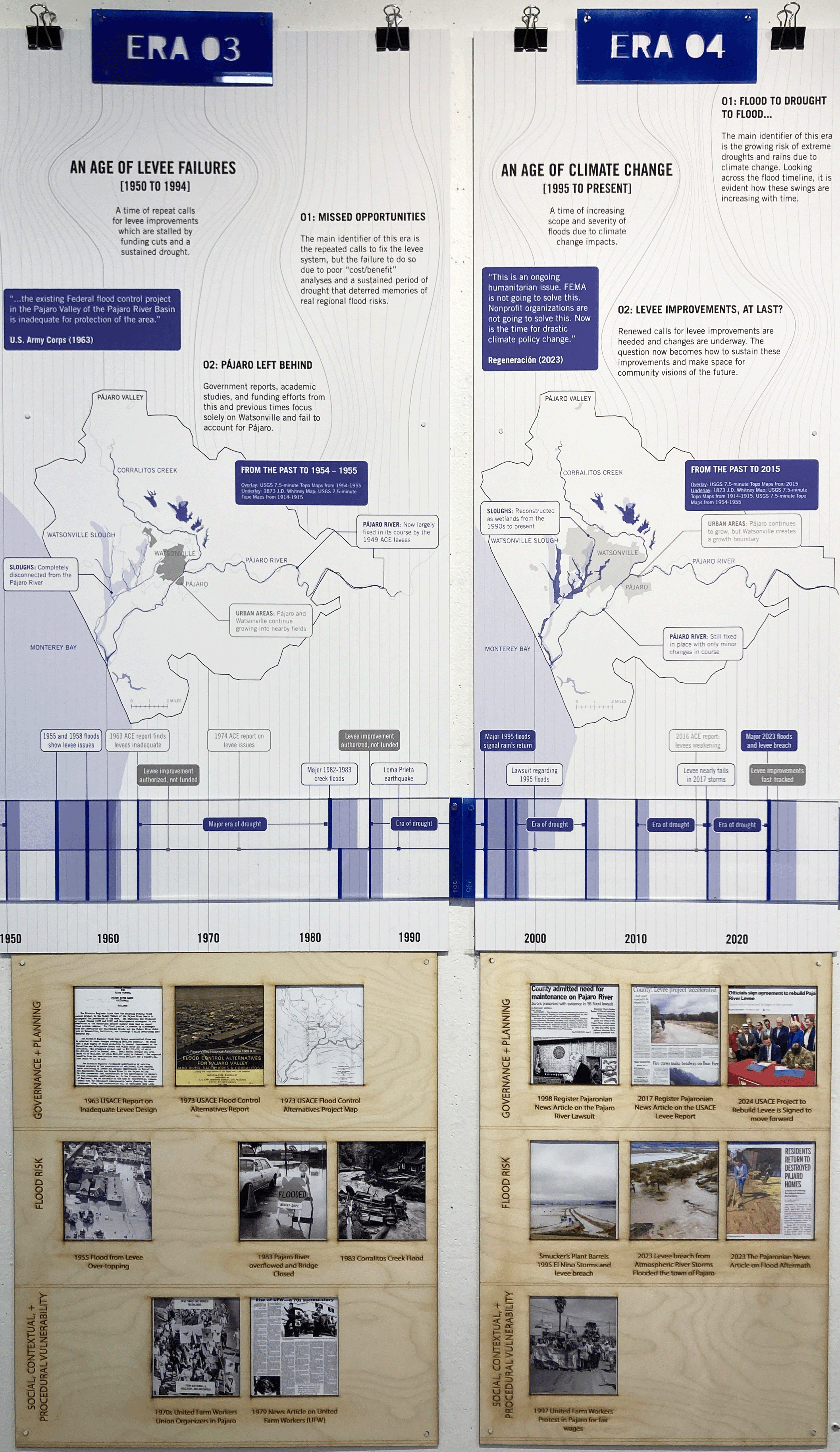
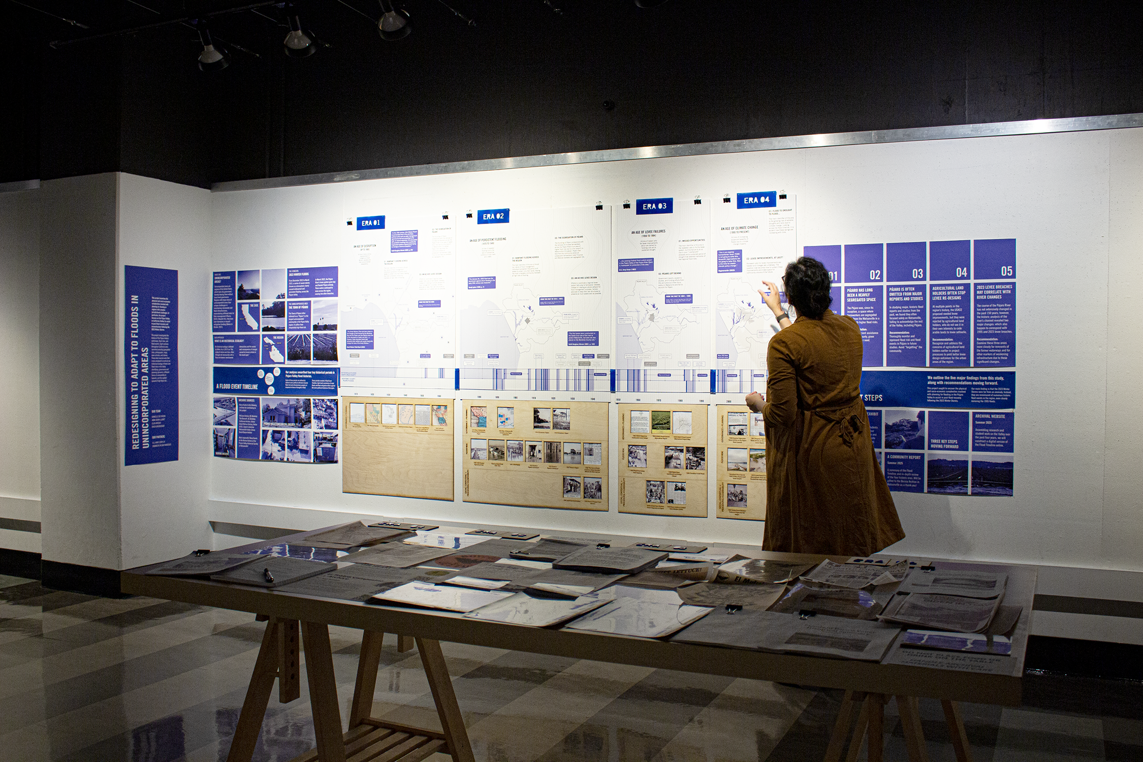
This project examines the difficulties in planning for flooding in regions with complex jurisdictional challenges. In particular, the project focuses on the Pájaro Valley in California (Valley) to assist in post-flood recovery and reconstruction following the 2023 Winter Storms. To do so, the project investigated the history of the Pájaro Valley’s waterways, flood risks, and flood events. To find this information, eight archives throughout the Bay Area and California were searched providing geospatial data, photographs, maps, news articles, and stories. These data sources were then cross-analyzed to construct a Flood Risk Timeline identifying four key periods in the region’s history of flooding.
Exhibit: April 7-29, 2025 - University of California Berkeley - College of Environmental Design
Authors: Danielle Zoe Rivera and Eliza Breder
Government Partner: U.S. Army Corps of Engineers at San Francisco
Funding: Lau Climate Futures Grant from UC-Berkeley’s Institute of Urban and Regional Development


Compounding Disasters: Geo-spatial Analysis of Risk
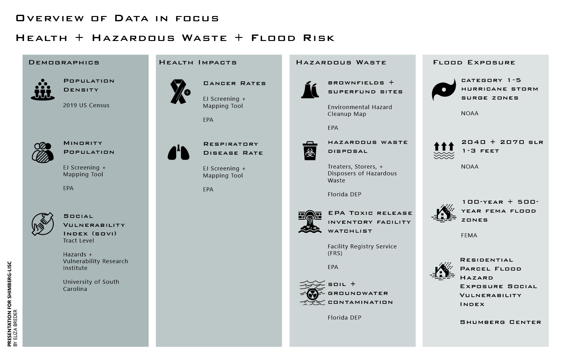
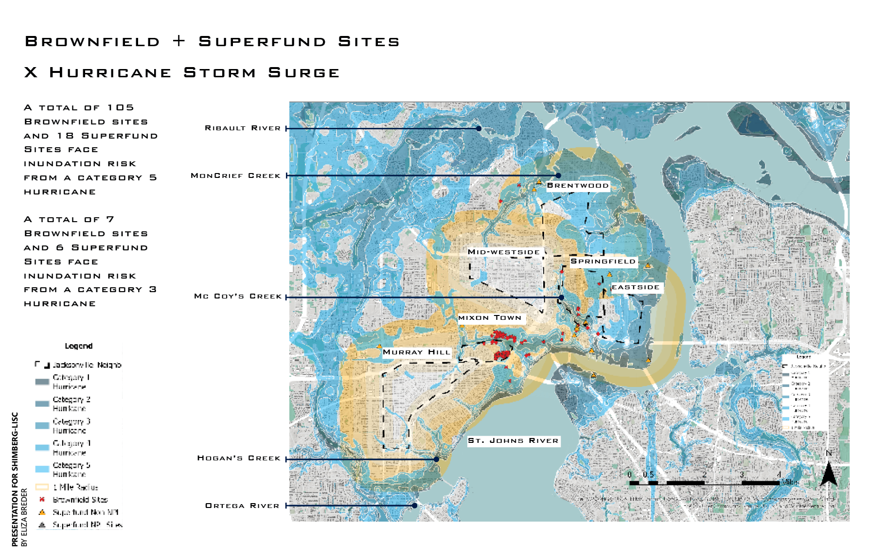
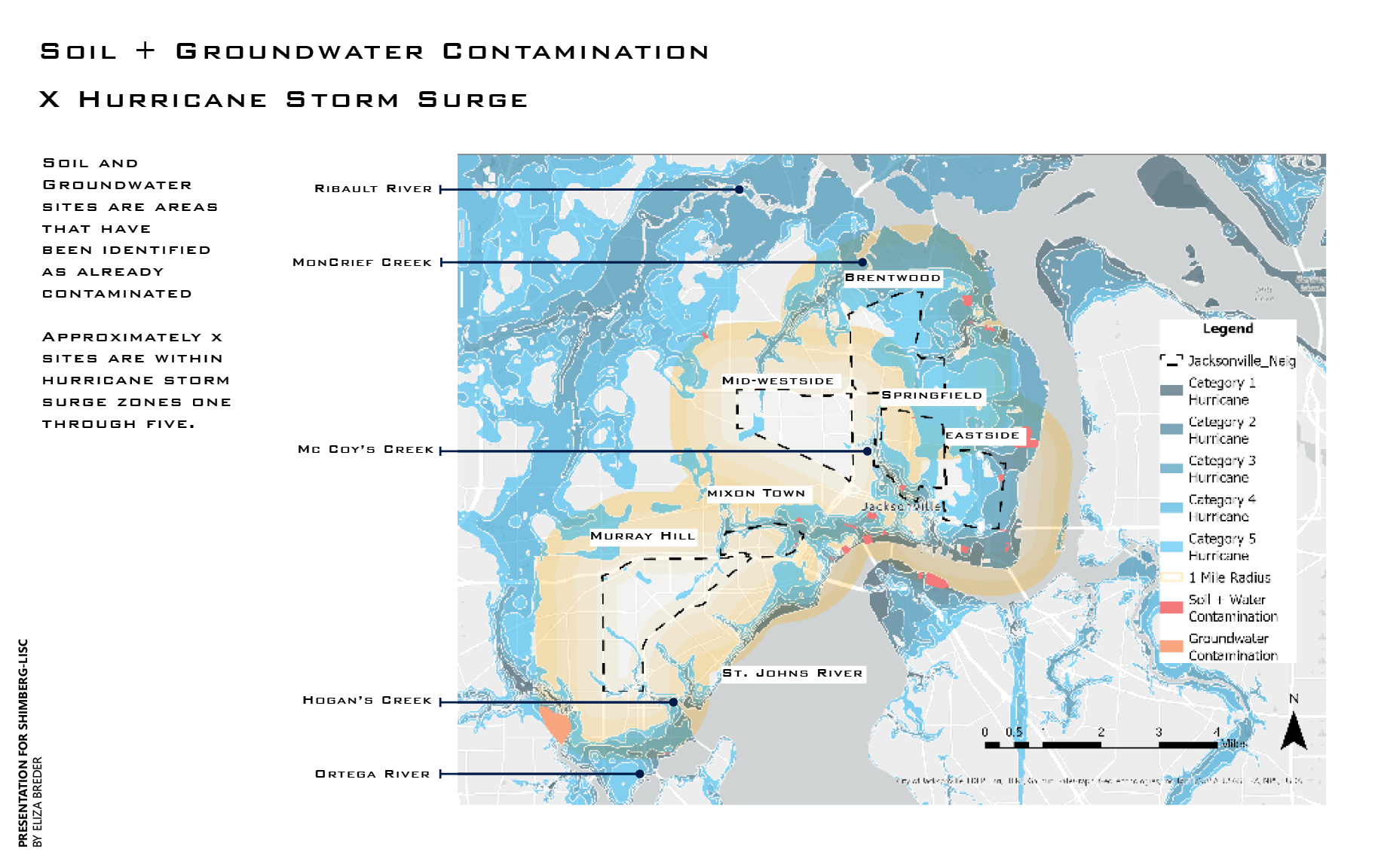
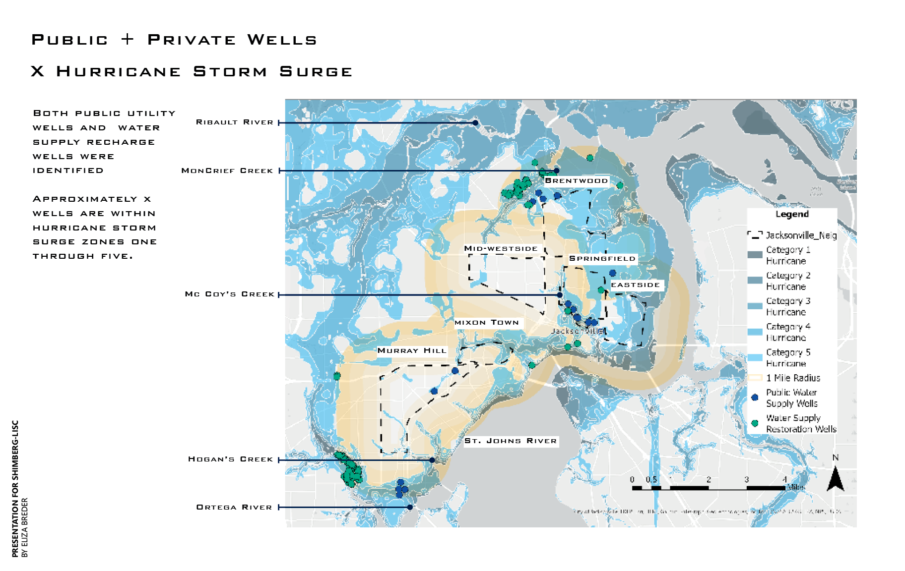
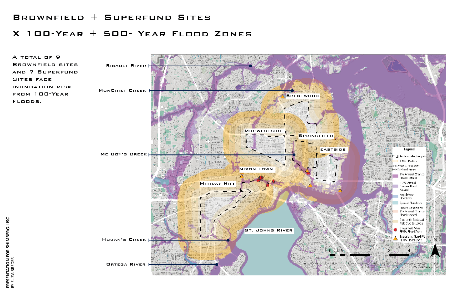
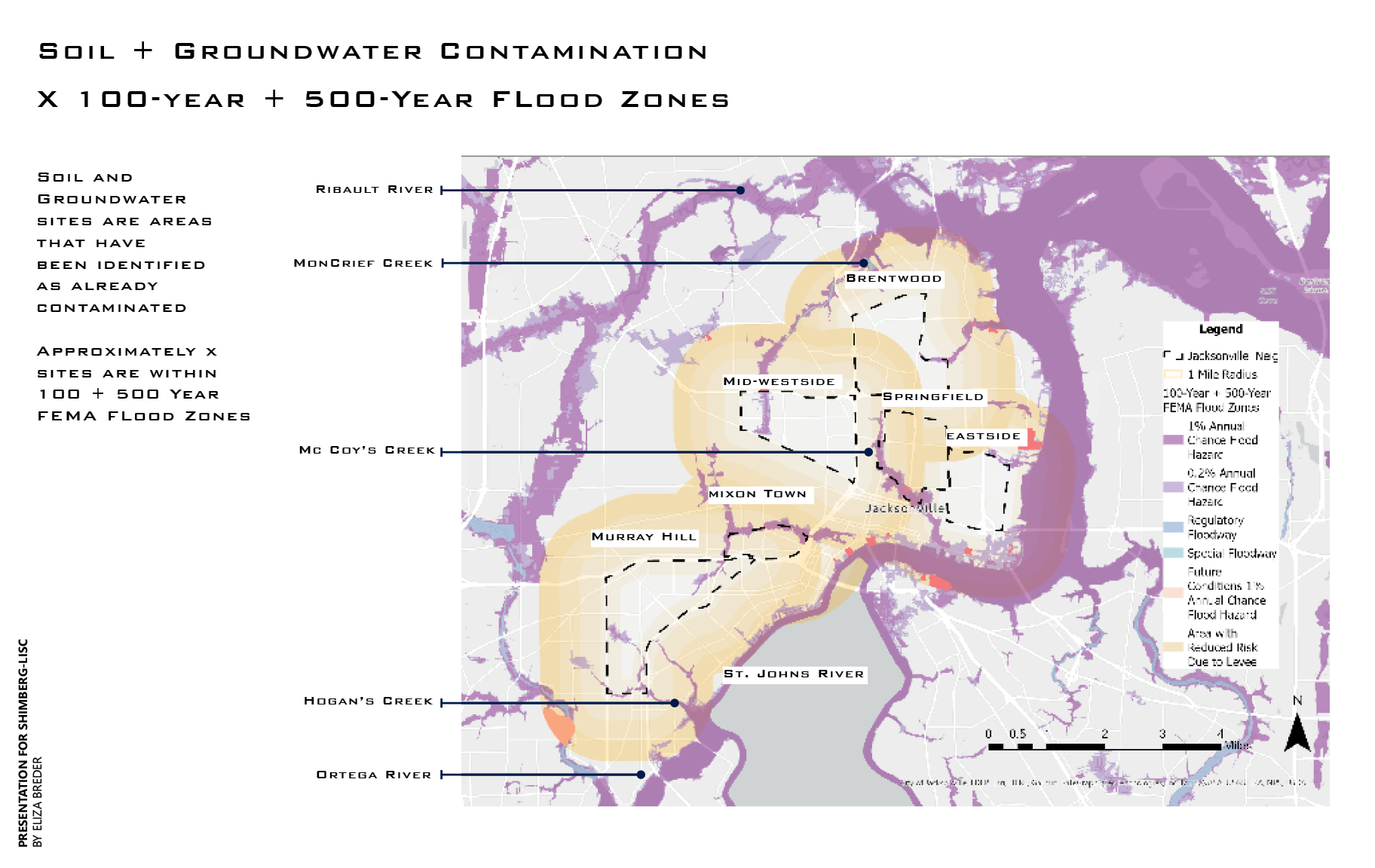
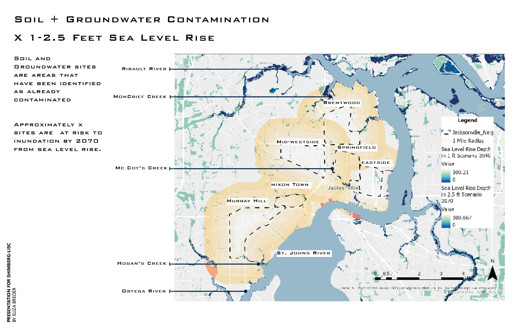
This work analyzes how flood risk and sea-level rise intersect with toxic-waste sites and groundwater wells in a historically Black community in Jacksonville. By overlaying hazard maps with environmental-contamination data, the study identifies where rising waters may mobilize pollutants, threaten drinking-water sources, and exacerbate existing environmental injustices. The analysis reveals how climate-driven flooding can intensify exposure risks for communities already burdened by industrial waste, highlighting the need for protective infrastructure, stronger regulatory oversight, and equitable climate-adaptation planning.
Author: Eliza Breder
Partner: Shimberg Center for Housing and LISC
Funding: Shimberg Center for Housing


Legacies of Redlining in Miami
Historically redlined neighborhoods experience several risks today including adverse health outcomes, lower property values, minimal green space, and disaster risk. There is a strong relationship between historically redlined neighborhoods and current health outcomes. The legacy of redlining has disparately impacted the Black community. Without immediately addressing brownfield cleanup in the face of increased hurricanes and sea level rise, these long-term impacts on health and wealth will worsen. The analysis found in this story map lays the foundation for understanding the accountability the US government, planners, and corporations must have in addressing these impacts.